

We pause at Henderson for petrol before heading through new road constructions out into a stark desert plain dominated by powerlines.

Little tufty bushes are the meagre groundcover with fabulous mountains in the distance and a massive solar array which looks like

Cars and caravans are dotted out on the plain in large cleared expanses. I can’t quite work out why. Do they do speed tests out here? Race quad bikes? Fly drones?
More solar arrays out there and what looks like sagebrush. Rather elegant and sophisticated power lines lead off into the distance looped from pole to pole.
The sun is hammering on the car.
Mist hazes the panorama. Occasional rude-looking little knobs of cactus dot the plain. Small yuccas, too, increasing in number as we drive west.
There are mountains on both sides, creosote bushes now on the land, and joshua trees increasing in number.

We pass a little town with the quaint name of Searchlight tucked in

Prominent in the town is Terrible’s Roadhouse. One just has to wonder.
Liquor stores, a casino, boats, advertisements for honey and jerky - and Searchlight is gone.

No more joshua trees on the land. It looks a bit scruffy out there.
We’re at 2550ft elevation a sign informs us. Oh, and what a neat little town approaches.
Cal-Nev-Ari.
I never saw a town name like that. Huh?
I reach for Google and discover it is the southernmost town in Nevada and it is a three-state town and hence name = California, Nevada, Arizona.
It has an airport and was set up as a fly-in town for pilots and their families.

The road narrows and presently has many dips. Five miles of dips. Sigh.
But the arid-lands vegetation has improved. There are little yellow wildflowers, white trumpet flowers, chollas in bloom, yuccas.
This is good habitat for snakes and lizards, says Bruce. Jack rabbits and ground spiders, too.
Rings of mountains continue out

For some blissful reason, when a junction appears, the trucks all go one way and we go the other. Cheering to have the road to ourselves.
Signs advertise pistachios, stuffed olives, and avocados.
We swing back onto Route 40, the old Route 66. And it is truck hell all over again. They are end-to-end.
Damnation.

A town called Needles. Hoardings, trees, mini storage, roadworks. Oh, my god, they are repairing the most hideous damage to the safety rail. Something ghastly happened here.
We pull into the Needles Maccers to gobble something down and use the facilities.
I try a McDonalds breakfast burrito, Ugh. Was I mad? Never again.

Look as we may, we can see only desert.
Mojave, says another sign. It is a big desert. We must have reached the edge of it.
There’s a caravan park with eucalyptus trees.
Low scrub, greeny brown bushes.
Ocatillo cactus start to appear. Bruce is delighted, albeit sad they are not blooming. They are pretty stick-like. But the chollas are blooming. They look haloed in the light. Gorgeous.

We pass the Chemehuerin Indian Reservation with its casino. The road is really busy.
We check out the radio which tells us that we need to buy a gun now while we still can. Every person must be a first-responder, the gravel-voiced jock lectures us. This is radio shotguntalk.com There are new guns out which are curved to fit around the body. We all need one in the event that something happens. You have to be able to take care of yourself. What is the most effective gun? It’s the one you have with you.
The land is still flat, vegetation stunted but there must be a watercourse out there, since there is a line of trees.
There are also lots of rocks. It looks like an Aussie gibber plain out there.
We turn onto 95 south. A funny little junction. Its 24-hour garage and motel is for sale. We wonder what life would be like running such a place in the middle of nowhere, for this is indeed, a nowhere sort of place. Not even a daisy chain of trucks is to be seen. Just open road.
Eventually a fenced yard of caravans and junk turns up. It has prominent security warnings. It looks so unncessary out here. No one would want the protected contents.
There is an Indian settlement nearby, dwellings dotted about the landscape. They don’t like to crowd each other, these native Americans.

Then a sign announces: Deer Crossing.
The Colorado River Community is announced with mountains close, rugged and mighty.
Lost Lake? How do you lose a lake?
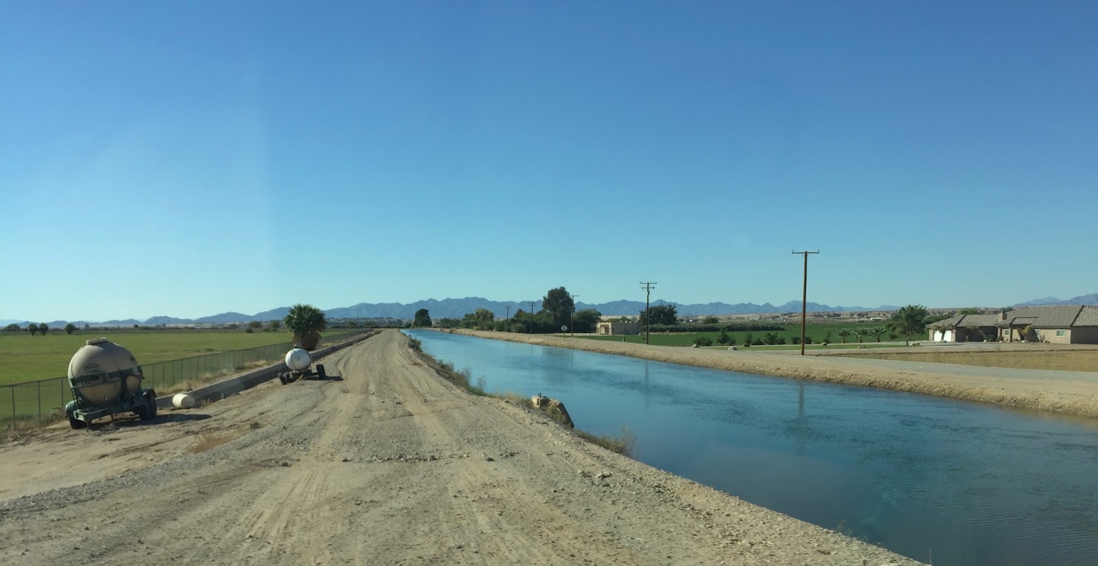
The vegetation of dense low scrub and winding, undulating road suddenly gives way to an area of massive cultivation. Hidden Valley is lush and green and irrigated.
But over there by the edge of the mountains, I can see sand dunes. What fascinating landscape.
And now a big, beautiful river, palm trees, The Water Wheel Resort.
We follow the winding ribbon of water, incredulous that we are suddenly in some sort of river resort area. There’s a jet ski high up on a pole. River shacks. A river community. It’s the Colorado River. Mini storage. Of course. There’s a boat for sale at the roadside and a caravan park called Paradise Point which does not look at all like paradise.

Another riverfront community. This one called Hidden Beach Resort.

Blythe is a town of palms and more palms. Big, relaxed, a desert rural town. Solar panels. Crops. Green alfalfa bales waiting in the fields.

Ripley, a tough working agricultural town, a huge ploughing machine producing clouds of dust out in the fields.
We’re on the back roads
A gate bears the label. The Other Side. Hmm
The landscape rolls softly. There are still mountains out there. The sky is soft blue, very pretty, with just a sleek streak or two of cloud. I see mica glinting from the soil. It is dry and barren, otherwise.
A sign warns that speed is enforced by aircraft.
I’ve seen a few of these around the country. Never saw any aircraft, though. I reckon it’s a bluff.
Ah, cactus are beginning to reappear on the landscape. We must be hitting that sweet altitude spot they love. Chollas and ocatillos. Bruce is purring at the sight.


It’s one of those great ironies that gold is a pretty thing but gold mines really quite grotesque.
As we speed on our way, we pass one of those completely mad people who cycle alone across the vast no-man’s land of wilderness America. Fat little panniers, hunched intensity from the lonely laboring rider way out here in the Mojave Desert.

I see sand dunes again. Big ones. There’s a little settlement called Glamis. It touts itself as The Sand Toy Capital of the World. Who knew?
The toys turn out to be
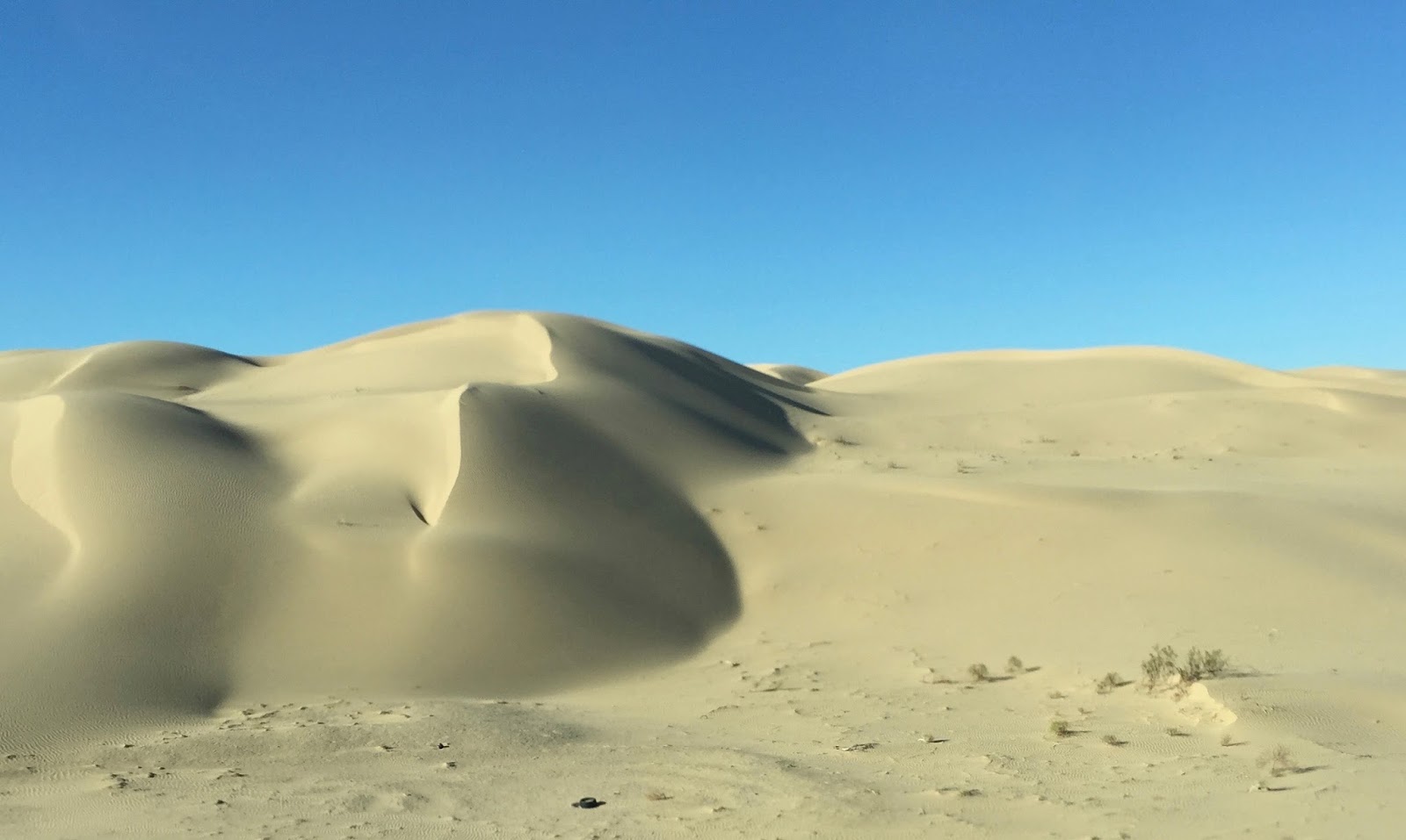

These are most imposing dunes. Sensational. Or should I say sandsational.
We pass a little town of trailers lined with cheerful flags - and lots of buggies.
Proper name is Glamis

And now, heaven help us, we’re beside the Salton Sea.
It’s a salt lake.
This wonderful road forges forth back into agricultural territory. Pecan and date orchards.
Alfalfa.
Stockyards belonging to the Mesquite Cattle Traders.
Our progress has been slowed by a lumbering chain of caravans. Not that we mind. This is wonderful country.
However, we are not sorry to find that they branch off onto another road. They are not going to San Diego.
Bruce announces that it is 88 degrees F outside. We have had pretty gorgeous weather throughout our six month road trip. Bruce hoped it would work out that way when he planned the route - taking the cooler northern states in the peak of summer and leaving the hotter southern states to the moderating temperatures of autumn.
It’s snowing today in New Hampshire, he gloats, where we spent seven lovely days in August.

We are very close to Mexico, says Bruce. We turn on the radio and sure enough, radio Mexico all over.
We enjoy some cheerful Mexican music and identify the California Coast Range as the mountains appearing ahead of us - crops on either side of us.
We cross the San Diego County Line and turn onto California 111 South.
Flat open road. Massive stockpiles of alfalfa bales are stacked by the roadside.
Billboards start appearing. Date Shakes. Local Honey. Local Olive Oil. Local Dates.
This is El Centro, says Bruce.
Nearby Indio is the date capital of the USA. We’ve been there before many years ago.
The road is good. Lots and lots more alfalfa bales and even some hay are stashed in mountainous blocks.
Fields now are of solar panels. The landscape is drying out.
We’re at sea level and we are back to bare undulating desert around us, reminiscent of the Badlands of South Dakota, but covered in bike tracks. There are a lot more people out here, I suppose.

Now a mountain which seems to be made entirely of boulders. Spectacular formations. Perilous as we climb into the range.
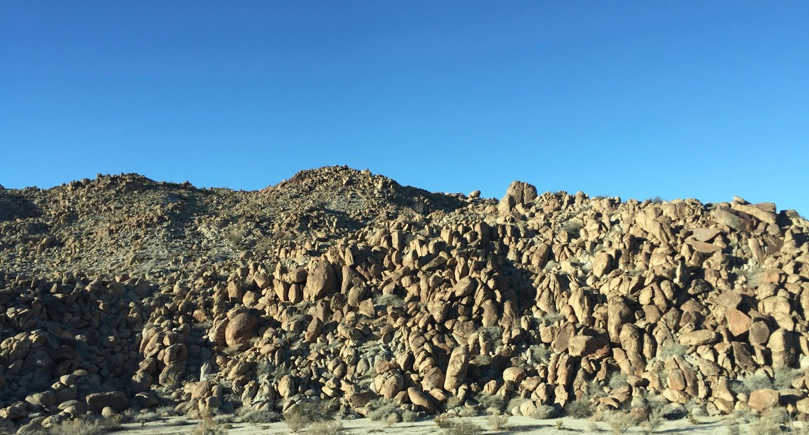
Giant electricity pylons are taking the wind power across the landscape. I love these gracious, grand pylons. They are pretty ladies in metal lace.
More cactus, cholla now. More rock pile mountains. Jacumba.
Our petrol is low. There have not been too many services out on the Sonoran desert.

It is still a bit back of the beyond. Finally I spot the petrol station. It is something from the 1930s. A crude bowser beside an even cruder shed of a store.
I don’t like the look at all.

This turns out to be not so fine.
He is given a key to open the magic blue door to the filthiest stinkiest lavatory I have seen since Yugoslavia 1971. Bruce says it reminds him of Mexico. You’d love Mexican loos, Sa.
I upend a ton of sanitiser and gingerly cope.

A few minutes down the road of course we spot a shining, gleaming, you-beaut modern servo. Oh well.
And down the road it is. We are at 4000ft and descending.
There’s a river in the valley within a lush corridor of cottonwoods. No hint of those glorious golden leaves. No one has told them about autumn over here in the west.
As we reach a valley, we reach also a Border Patrol point.
Lots of official vehicles lined up. Lots of officers spread about. Traffic in a bottleneck. It feels very

They are looking for illegals. We don’t fit the profile. When our turn comes, a dazzlingly handsome young man in uniform simply smiles and beckons us through.
On the other side of the mountain we hit a landscape of dense shrubs, pale rocks, and pointy hills with pointy pines.
We pass the Viejas resort and casino, a brown place if ever one there was.
And lots of signs of habitation. Pencil pines and mission-style buildings. Sycuam Indian Reservation with a lovely lake and handsome properties. We’re still descending. 1000ft now. 84 deg outside.
White fences. Horse properties. Low sun.

It is our last road trip stop. A special one.
Come on Siri Google. Lead us to our digs on the shores of Mission Beach.
Hey samela you're only 6 hours from our ranch and our nephew the US Marine is based there. How long before you head home?
ReplyDelete